
Habitat Analysis
Environmental Modeling
2024
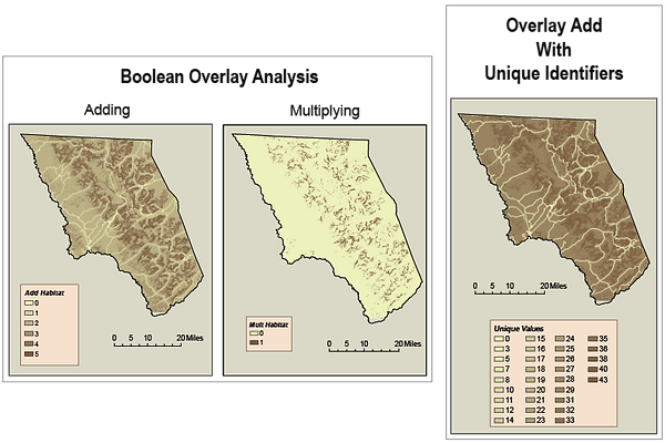
This analysis identified three key criteria to determine the most suitable habitat for Bighorn Sheep within Glacier National Park: terrain with slopes between 27 and 85 degrees, areas featuring open or semi-open habitats such as alpine meadows, open grasslands, and rock outcrops, and regions with minimal human activity and disturbances. Several maps were created to explore these criteria and their implications. The Mult Habitat Map shows the results of multiplying key desirable features, while the Add Habitat Map illustrates the outcome when these features are added together. Although these two maps yield identical area and perimeter measurements, their visual representations differ. The Unique Values Map assigns unique identifiers to suitable features, which are then combined for analysis. The Weight Suit Map highlights the effects of applying varying weights to key features, revealing which are more or less critical. Finally, the Other Weights Map demonstrates additional adjustments to these weights for further refinement. Together, these maps provide a comprehensive understanding of habitat suitability and the relative importance of specific features.


Colorado Parks & Wildlife
Internship
2024
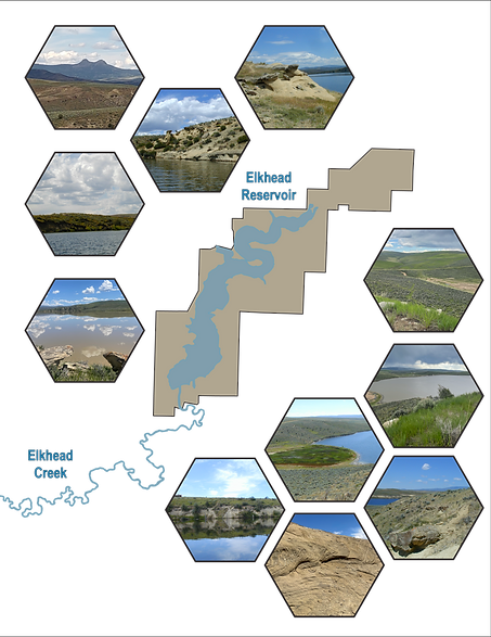
This internship has been an exceptional experience, allowing me to refine my proficiency in ArcGIS Pro for data analysis, map creation, and database management. During my time with Colorado Parks and Wildlife through CU Denver, I contributed to building a geodatabase for Colorado State Parks by collecting and integrating geological and paleontological data into GIS layers. Through fieldwork, I gathered data and photographs, digitized geological features, updated attribute tables, and supported park management and research initiatives. Additionally, I played a key role in organizing and leading a field trip to present project findings to park staff, further enhancing my analytical skills, attention to detail, and ability to communicate complex information effectively.
Elkhead Reservoir State Park

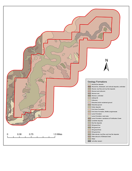

Geology Formations Map
Rockfall Hazards Map


Neighborhoods:
Visualizing Food Retailers and Accessibility
Introduction to GIS
2023
The project examines the accessibility of food retailers in Denver neighborhoods, focusing on walkability within a 0.2-mile radius. Using GIS tools and data, I analyzed three neighborhoods—Berkeley, Capitol Hill, and Cherry Creek—chosen for their diverse income levels and characteristics. From running analysis, I was able to find that higher-income areas generally have better access to grocery stores, while lower-income areas rely more on convenience stores and small food markets. Maps created for the project showcase income levels, store locations, and accessibility features like bus routes and parking. Findings highlight disparities in access to food retailers based on income and geography, with GIS proving invaluable for visualizing these patterns.


